
Why Drone Photos Matter in Real Estate (and When They Don’t)

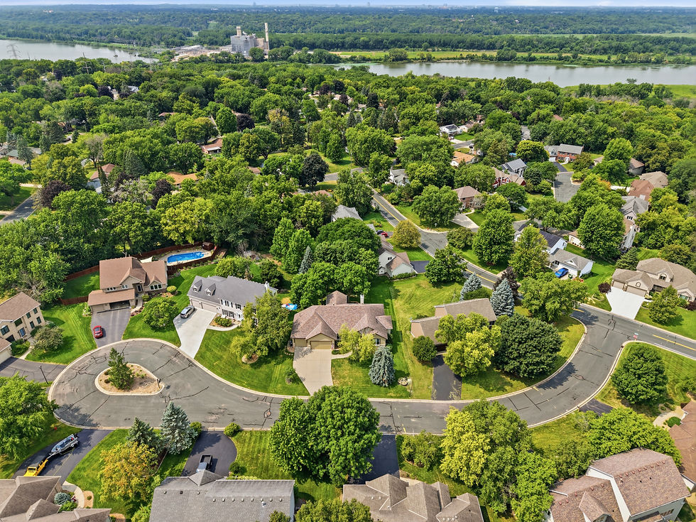
Drone photography has become a regular part of many Twin Cities listings, and for good reason. When used well, aerial images give buyers a perspective they simply can’t get from ground-level photos. But like any tool, drones aren’t automatically useful on every property. Understanding when they add real value — and when they don’t — helps sellers and agents make smarter decisions.
Why Drone Photos Matter
Most buyers start their search online. They’re trying to understand not just the house, but the property as a whole: how the lot sits, what the surroundings look like, and whether the location matches what they’re looking for. Ground photos show rooms and curb appeal. Drone photos show context.
Aerial images can reveal:
Lot size and shape in a way that floor plans and street views can’t
How the home sits relative to neighbors, trees, or open space
Proximity to lakes, parks, trails, or other local amenities
Views that aren’t obvious from the ground
The overall flow of a larger property (driveway length, backyard depth, outbuildings)
In the Twin Cities metro, this context often matters. Many suburban and outer-ring properties have larger lots, mature trees, or nearby water features that are hard to communicate with standard photos alone. Even in closer-in neighborhoods, a well-timed aerial shot can show how a home relates to a park, greenway, or quiet street — details that influence buyer interest.
Drone photos also help listings stand out in crowded search results. A clean aerial image at the top of a gallery signals that the property was presented thoughtfully. That small signal can increase the chance a buyer pauses and looks more carefully.
When Drone Photos May Not Matter
Not every listing benefits equally from aerial photography. In some cases, the added images provide little new information and may not justify the cost or effort.
Drone photos tend to add less value when:
The property is a condo, townhome, or small urban lot where the surrounding density is already clear from street-level images
Neighboring buildings or trees block useful views, so the aerial shot mostly shows rooftops
The lot is modest and the key selling points are interior finishes or the home’s condition rather than outdoor space
Privacy concerns or local restrictions limit how low or close the drone can fly
Weather or seasonal conditions in Minnesota (heavy cloud cover, snow, bare trees) make the aerial view less appealing than ground photos taken under better light
There’s also a practical consideration: not every buyer cares about the aerial perspective. Some focus almost entirely on the interior and floor plan. For lower-priced listings or properties where the outdoor space is limited, the return on drone photography is often smaller.



Comments